October 01, 2015
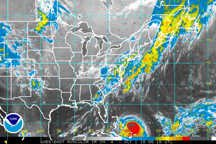
Forecast concerns jump from a possible tropical storm offshore to a Category 4 Hurricane in just 48 hours . Despite a relatively slow season so far, all of a sudden a rather important weekend ahead.
At 5AM EST Sept. 30 Tropical Storm at 70 mph, and 988mb.
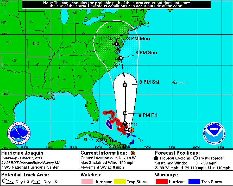
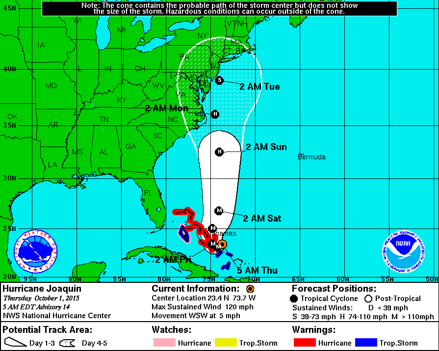
At 2AM EST Oct. 1st CAT 3 Hurricane at 120 mph, and 948mb
The storm has become 50 mph stronger and the pressure has dropped to 948mb, it was as high as 988mb late Tuesday night, that’s down 40mb in less than 24 hours.
This is a perfect example of why tropical systems are so respected, and why we pay to have a National Hurricane Center.
Joaquin now a much stronger storm with much bigger consequences. The closer it tracks to the coast the greater the impact, And look at the forecast now, …
INIT 01/0300Z 23.8N 73.1W 100 KT 115 MPH
12H 01/1200Z 23.5N 73.8W 110 KT 125 MPH
24H 02/0000Z 23.6N 74.5W 120 KT 140 MPH
36H 02/1200Z 24.7N 74.8W 120 KT 140 MPH
48H 03/0000Z 26.6N 74.7W 110 KT 125 MPH
72H 04/0000Z 31.6N 74.7W 95 KT 110 MPH
96H 05/0000Z 36.2N 75.6W 85 KT 100 MPH
120H 06/0000Z 38.5N 76.5W 55 KT 65 MPH
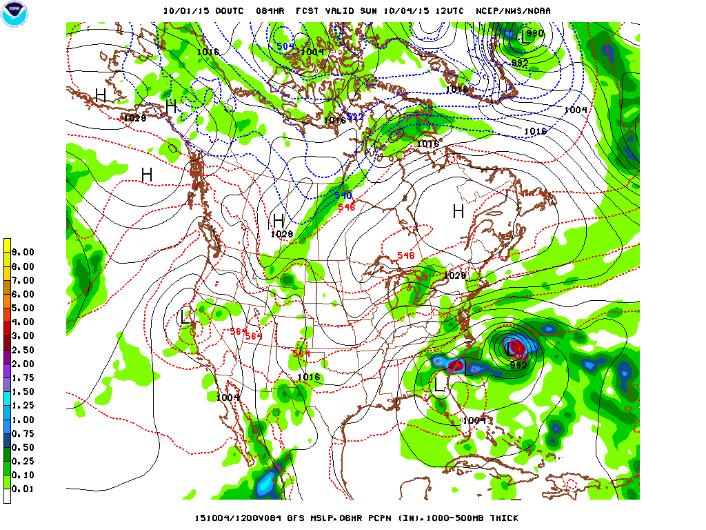
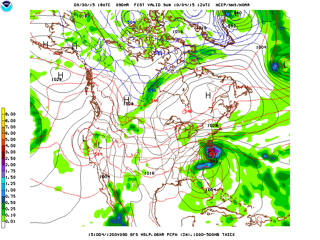
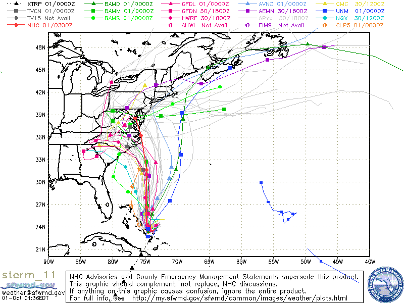
The Hurricane Center forecast finally comes back toward the coast, and of course the model that has been so onshore with its track, now runs more parallel along the Delmarva and Jersey coast . Tonight the forecast track looks more like a stronger Irene than a hooking Sandy. Below, most recent Sunday morning forecast showing Joaquin well offshore and headed north, below that, Sunday morning forecast 6 hours before showing Joaquin settling into Southeast Virginia. So this is still a developing situation, everybody needs to watch from the Carolinas up through New England, and be ready to act. Life threatening conditions may be experienced as early as late Saturday along the Outer Banks of North Carolina..
Forecast for Sunday morning, 12z is 8 AM EDT, above 00z run Oct. 1, below 18z run Sept.30. Consecutive runs 6 hours apart, different solutions.
The storm is much stronger, but fortunately has not moved much yet. It s really not far from where it was last night.
Spaghetti models still appear to be hanging on to the hook in this chart But these update every 3 to 6 hours depending on the model. So some change is likely in this product as well as time passes.
This is probably the biggest tropical weather forecast for the Middle Atlantic Coast and New England since Sandy. So the drama associated with this event is just beginning.
Last recon currently posted is 948mb, just for comparison in 2012 Sandy was 946mb at landfall. Irene was 951mb in 2011 when it first reaches North Carolina . Both Irene and Sandy were very costly storms, the fact we can make these comparisons shows the gravity of the situation. But Joaquin is forecast to get even stronger, so much more in the days ahead as we watch to see what happens to the East Coast.
Wild Bill.
