October 02, 2015 Friday
A BIG sigh of relief…Still some questions
Now all of a sudden, track forecasts for Joaquin are trending not only off shore, but well off shore. So, overall a much brighter outlook for the weekend for the Eastern Seaboard, although still a few issues. Joaquin is a large, strong storm and will be pushing against a large high pressure system over Eastern Canada.
Let us look at the same products we have viewed in recent days and track the progress of our system. First, the Hurricane Center track is now well offshore.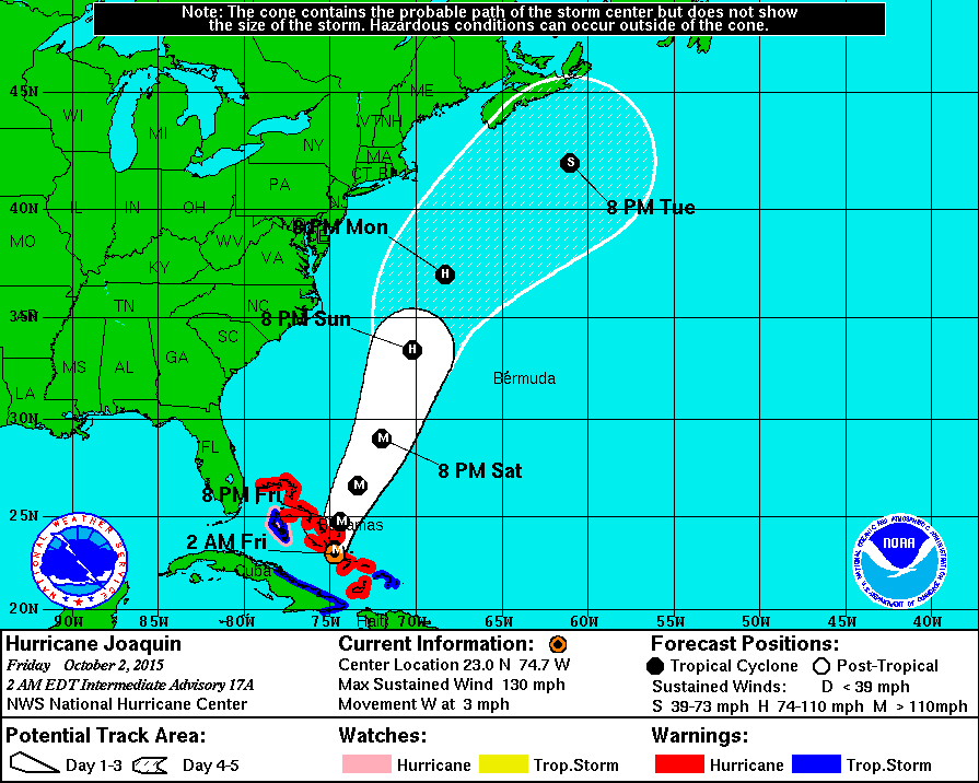
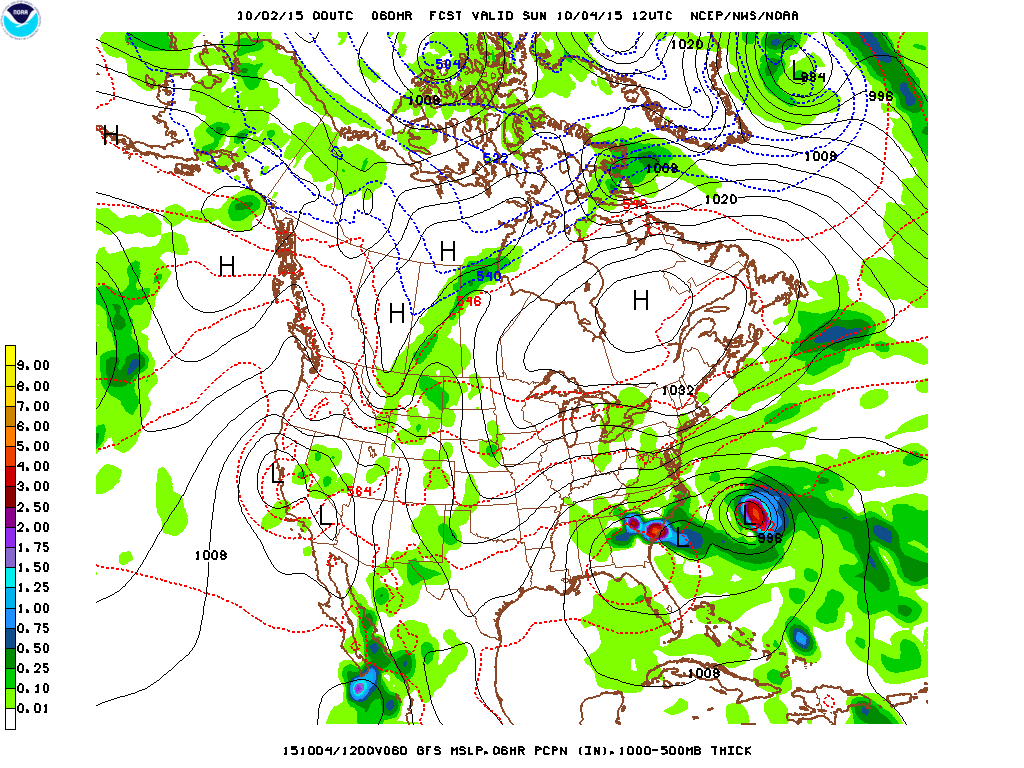
Now the forecast for Sunday morning from the GFS, looks much like yesterdays run with the Hurricane well east of North Carolina.
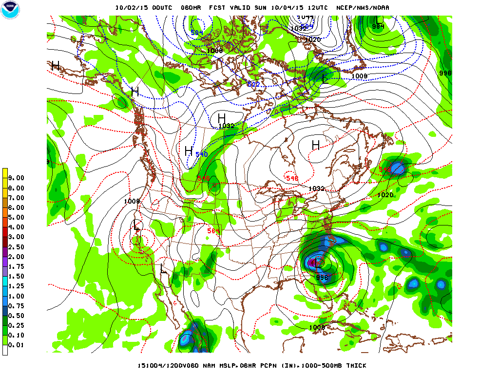
Here the forecast for Sunday morning from the 00Z NAM and there is our storm just a few miles from Savannah. So, not all operational models are on board with the out to sea idea. And over three days the Sunday morning position of our Hurricane has swung from Southeast Virginia to Southern New Jersey to a position closer to Bermuda.
So, with all that has gone on with this storm in the last 3 or 4 days , I suspect there may still be a wrinkle or two before this is completely over. Also notice in the pic below the storm really has not gone very far in the last 48 hours. It is still in the Bahamas southeast of Miami. I have worked with this stuff for years and it still amazes me. The storm itself has barely moved, but the forecast positions have drifted literally hundreds of miles.
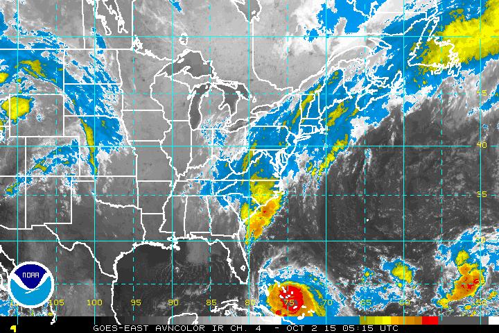
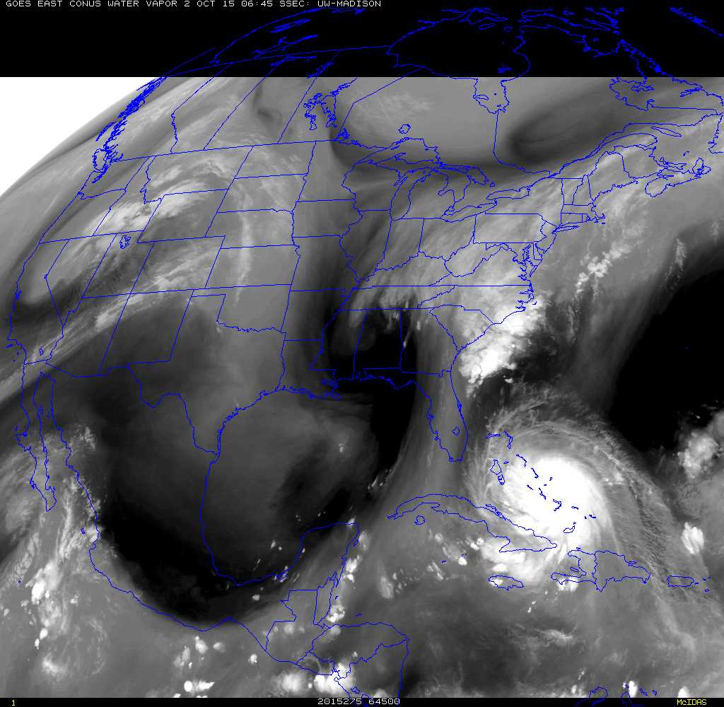
The water vapor channel overnight clearly shows the Sandy-like upper disturbance that has developed over Alabama and Georgia. It is the development and evolution of this particular feature that has made and may continue to make the forecast so difficult and changeable.
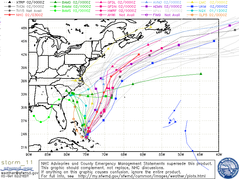
We will end with a positive chart, the spaghetti plots are currently mainly well offshore.
Stay tuned.
Wild Bill