October 10, 2015 A little hung up on what is next.
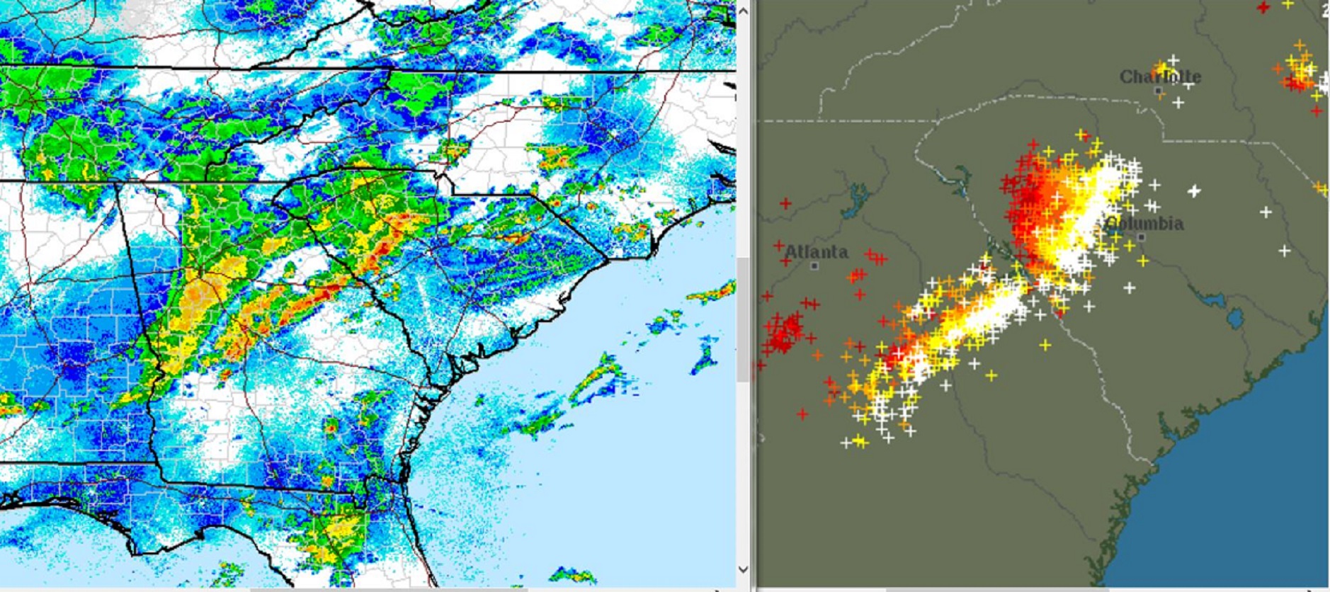
The South Carolina disaster hit a little close to home. I feel like I need watch all this a little more closely. Which by the way is really the theme of my new e-book. You have got to watch and be aware.
In my latest e-book El Niño: The WILD side of the weather cycle… I expressed my opinion that a specific weather forecast beyond 4 or 5 days tends to become climatology. What is considered “normal” for that location and time of year. But our current running GFS model, the Global Forecasting System, produces solutions out to 15 days.
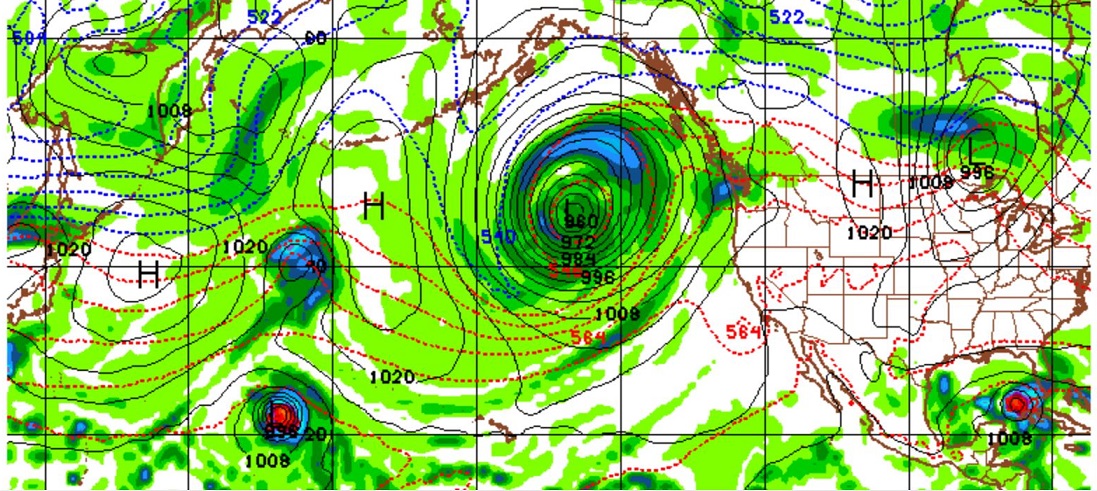
So, in the spirit of “what could possibly be next”, let us run that GFS model and see what we find. Last blog I left you with this forecast panel of the pacific.
GFS model for the Pacific at 300 hours or about 12 days out shows a 960mb low. This was on the 7th so, a 12 day forecast would be around Monday the 19th.
We are looking at a 960mb low Monday the 19th somewhere west of Washington State.
Yes, another tropical system in the East Pacific forecast to become a hurricane.
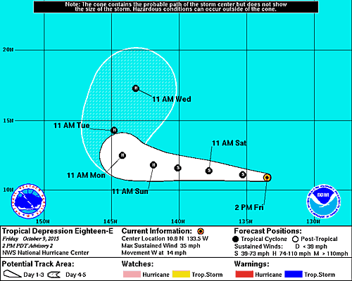
One run of the GFS today thinks next Sunday the remnants of this system will be west of Santa Maria headed into California. Not the end of the world, the system looks quite small. But after Joaquin last weekend and Hurricane Oho spinning past Hawaii this week, how could there even be the possibility of another tropical system affecting the U.S.?
It is just one model run. There are 4 in a day and it is over a week away. In South Carolina a week changed the landscape. But like in a novel, you must suspend the disbelief.
GFS 18z run 210 hour forecast for Sunday October 18, 2015 12z
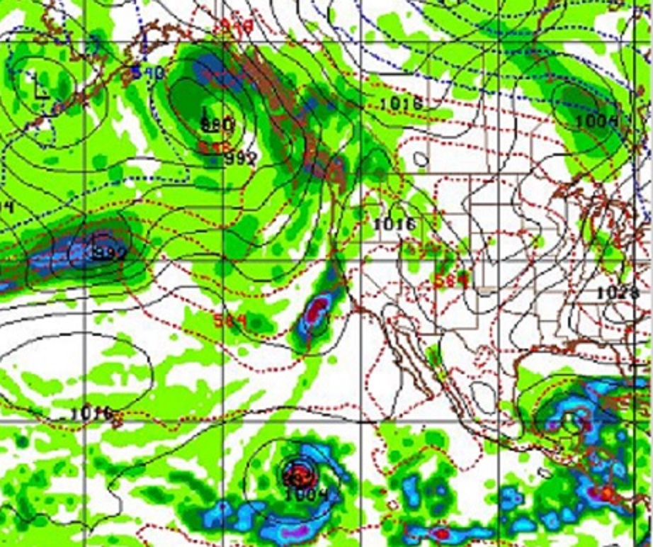
In the next six panels, the model takes the remnants of what will become Hurricane Nora, and swings her right up to California and into San Francisco Bay area by late Sunday.
And yes by panel 6th panel we are at Monday morning October 19. Moisture from Nora still in California, and only a 964mb low west of Washington State. We start all this with the snapshot of a 960 pacific low. Also the disturbance in the Gulf of Mexico depicted the model 2 days ago appears to be alive and well.
Go to full screen and increase your page size to 200 for the best view of the graphs below.
GFS 18z run 174 and 186 hour forecast for Saturday October 17, 2015 00z and 12z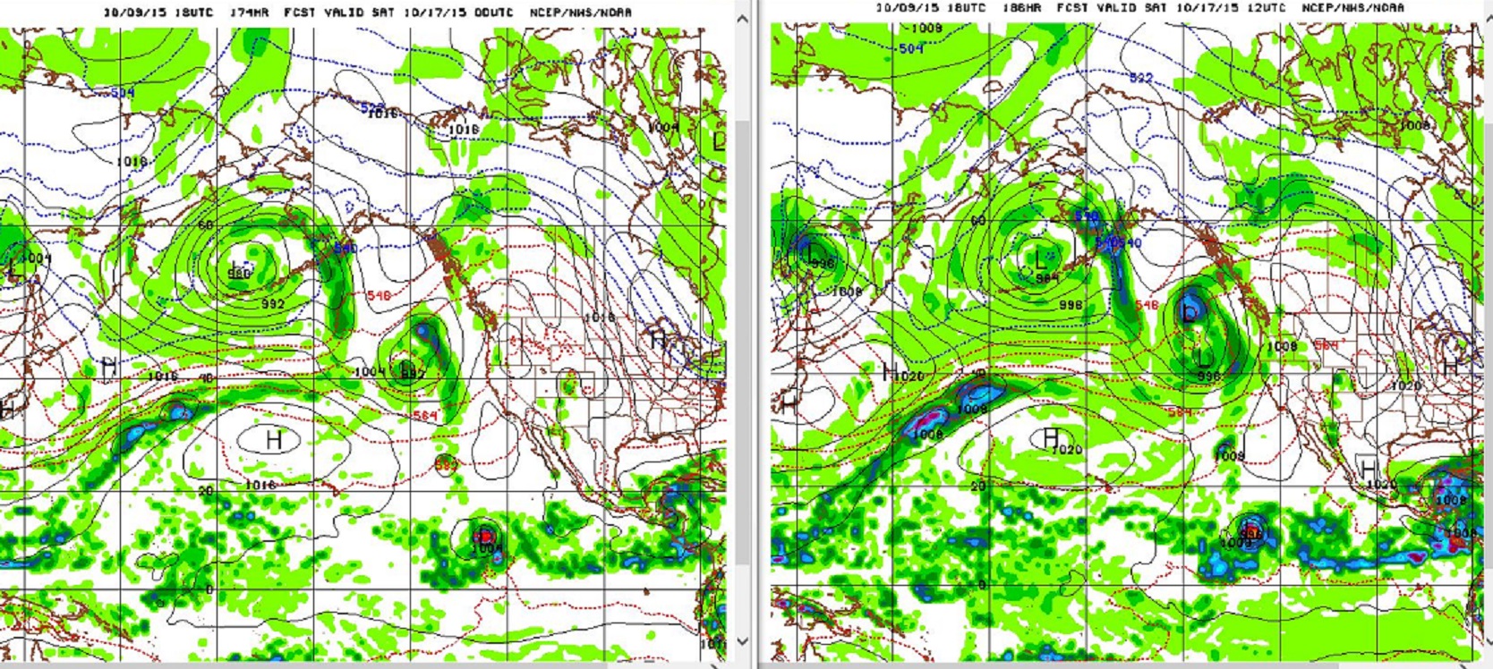
GFS 18z run 198 and 210 hour forecast for Sunday October 18, 2015 00z and 12z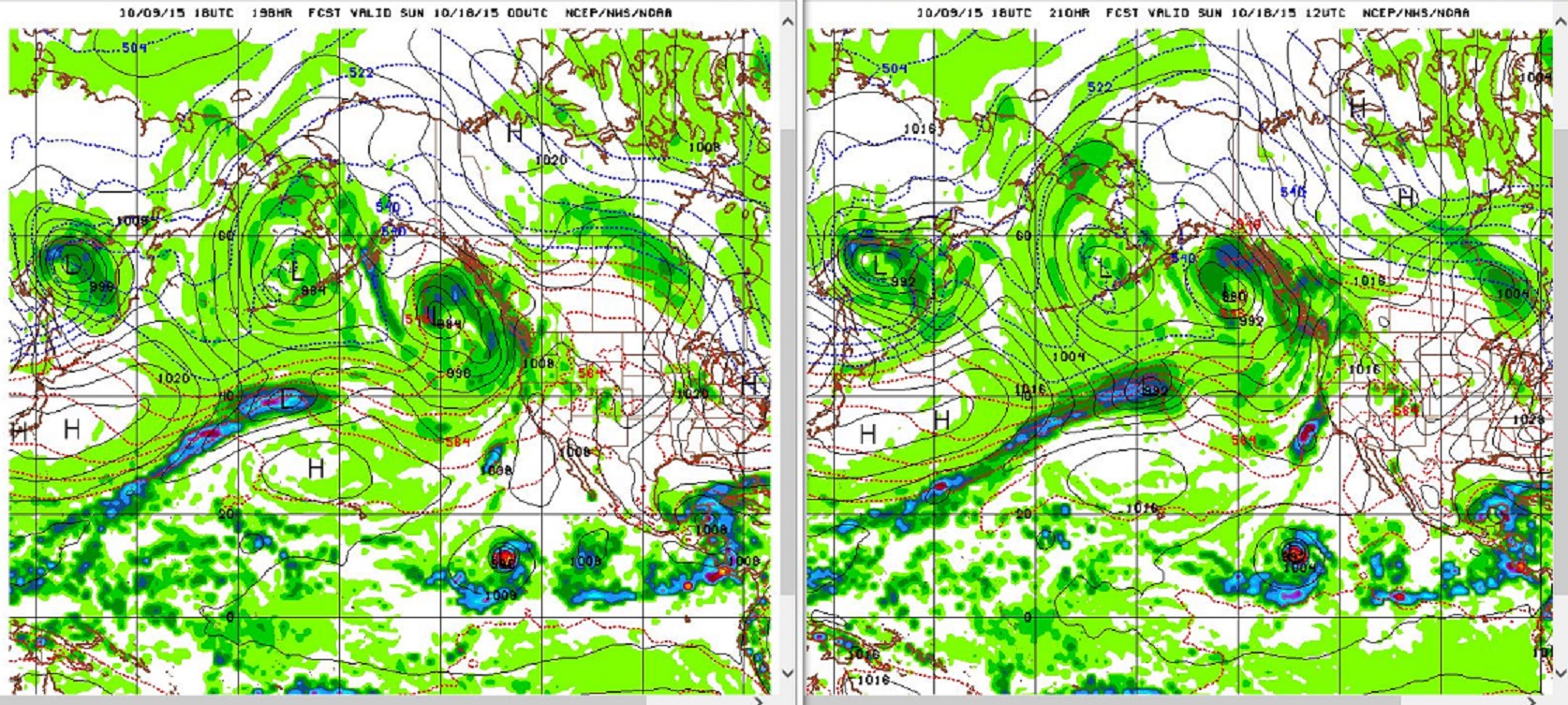
GFS 18z run 222 and 234 hour forecast for Monday October 19, 2015 00z and 12z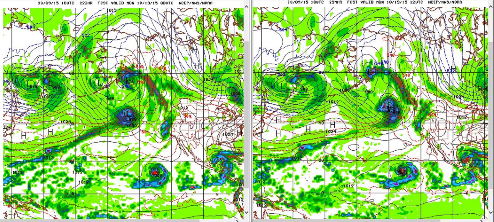
So, if this weekend is quiet and pleasant where you are enjoy! Tropical activity in the Eastern Pacific is a sign El Niño is alive and well, and that means more amazing weather is just days away.
Learn more in my latest e-book El Niño: The WILD side of the weather cycle…
What we know, What we don’t, and Why you should care!

Available at Amazon
Wild Bill