November 12, 2015
A quick update on the forecast models, despite various similar configurations during the day on Wednesday, this overnight run looks very much like yesterday’s stormy run, except a day early. I like this forecast panel because its a great illustration of high amplitude flow. Big storms but also big highs. If this forecast panel is close to actual, then while a storm rages in the middle of the country the east coast will feel like summertime in November. One region getting pounded and destroyed while another area is dry and pleasant and cannot imagine what all the fuss is about.
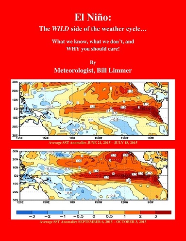
In Chapter 2 of my latest e-book El Niño: The WILD side of the weather cycle… I describe how El Niño may fuel a series of storms over a particular region, and those storms release energy. That released energy can build big warm dry ridges. I do believe forecast panel below could be considered evidence of El Niño already hard at work disrupting North America’s weather pattern.
It is happening, … the focus is shifting from the Pacific tropical season to the active and sometime deceiving winter pattern across America.
The possibility for next week:
Forecast map of 500mb flow 00z run for November 18, 2015 at 12z or 6am Central Time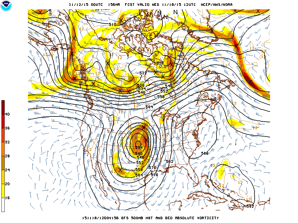
The 500mb map above shows the flow, the jet stream.
The surface map below shows the moisture, rain and snow, and temperature. Where the green shading occurs with the blue lines, northwest of the “L” in Kansas, snow is the more likely form of precipitation. The purple line down the Mississippi Valley is probably severe weather with flooding rain. With the balled up nature of the 500 flow the band of precipitation would move rather slowly increasing the flood threat.
Forecast map of surface features 00z run for November 18, 2015 at 12z or 6am Central Time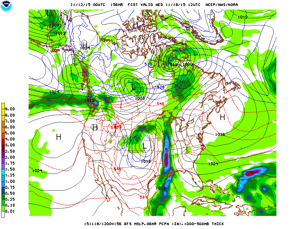
So, big hook or broken 9 of precipitation draped across the north central states down to the Gulf Coast in the forecast for next Wednesday.
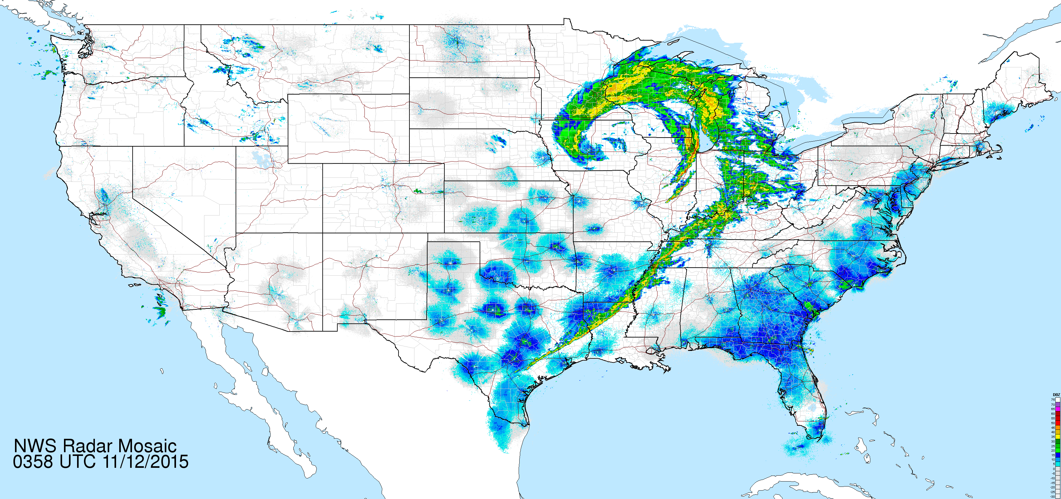
And Deja Vu, from national radar and satellite from this Wednesday evening November 11, 2015, a big broken 9 draped over the of the north central part of the country.
El Niño may fuel a series of storms over a particular region, …
Picture of the Day shows a snow covered Mt. Lassen in the afternoon sun. The mountains of Northern and Central California have whiten in early November as some moisture has actually worked into the region.

Learn more in my latest e-book El Niño: The WILD side of the weather cycle…
What we know, what we don’t, and WHY you should care!
I show how this years Pacific water temperatures compare to the 1982 and 1997 events and highlight the kind of weather episodes that these stronger El Niño’s tend to bring.
If you like the blog you will love the book.
Wild Bill