March 08, 2019
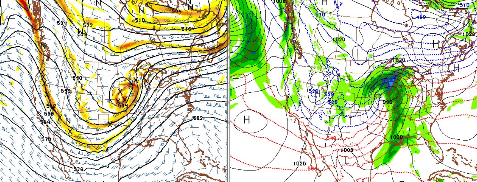
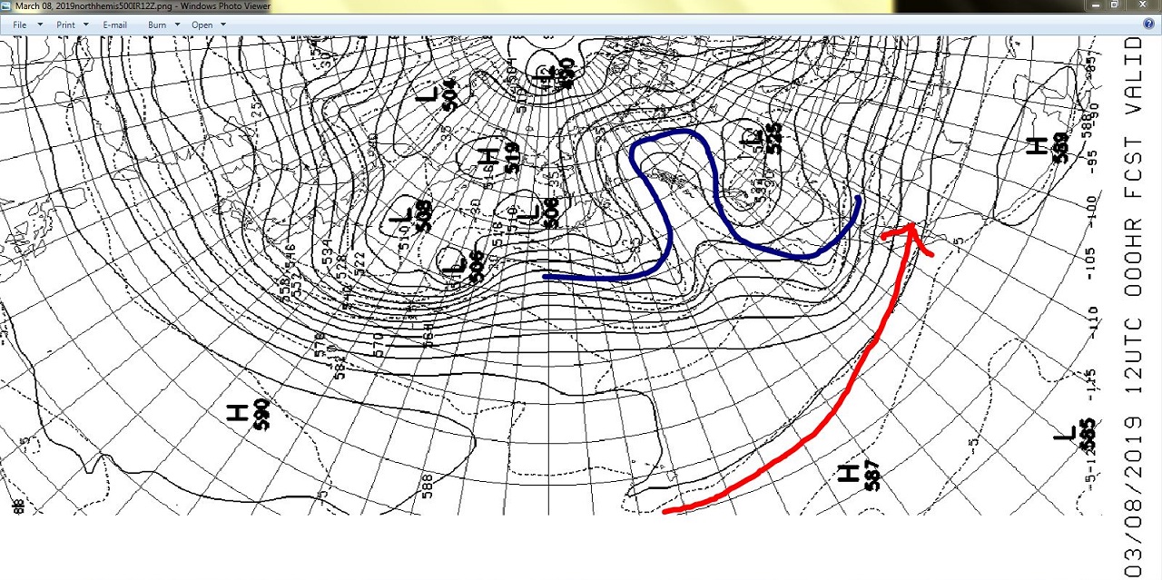
A week has passed since my last blog on the current Pacific weather pattern. The Blocking Eastern Pacific weather pattern lingers, and that means more activity weather for many parts of the country. First chart is of course the 500 mb flow across the Pacific. I have used the blue color to outline the now familiar Omega configuration of the Blocking pattern. The red line shows the tropical connection that also lingers in the Eastern Pacific. The 500 mb chart is from Friday morning at 12z UTC.
The GOES West snapshots below illustrates how the trail of clouds and moisture runs from south of the Hawaiian Islands northeast all the way to the Central US. For reference it is 2500 miles from Hawaii to California , so this plume of moisture may stretch as much as 4000 or 5000 miles from the Equatorial Pacific to Central portions of North America. The first picture is from Thursday evening, 00z UTC March 08.
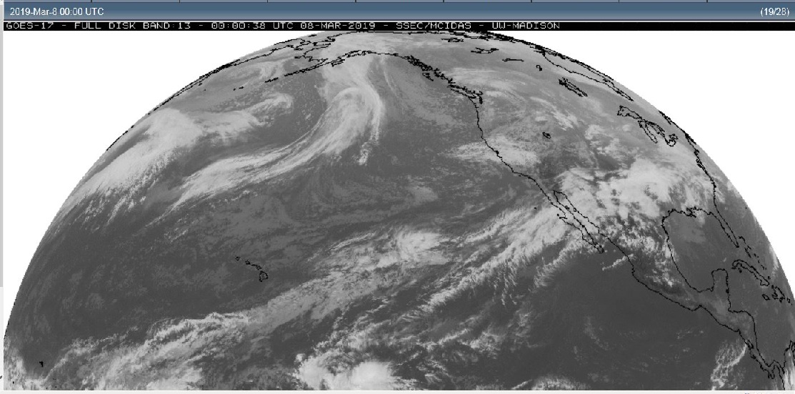
The second frame is from late Friday afternoon or 2200z UTC. In this second picture the cloud pattern over the Alaskan panhandle actually shows the same Omega configuration . It also shows moisture surging into North America as our Pacific disturbance moves east.

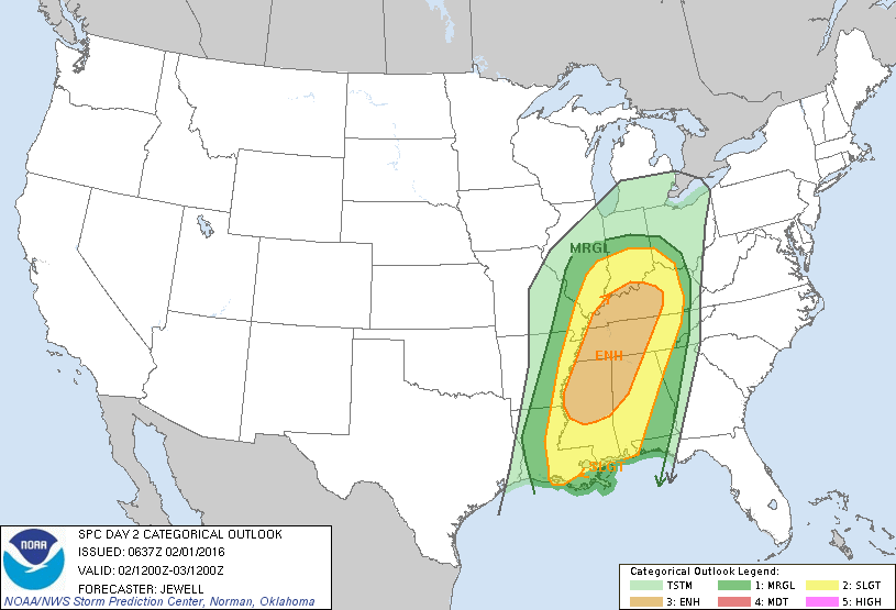
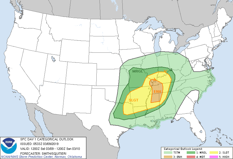
Along with keeping the west coast active with snow and rain, and this past week even a round of thunder and lightning over Southern California. This most recent system is headed toward the Central US. with a threat for severe spring weather. So, similar to last weekend, a storm system with a Pacific and Arctic connection will lead to more active weather including the threat of tornadoes. This weekend Saturday appears to be the day with the greatest threat of severe weather. The threat for tornadoes is greatest in the center of the highlighted area in the Storm Prediction Center’s graphic below.
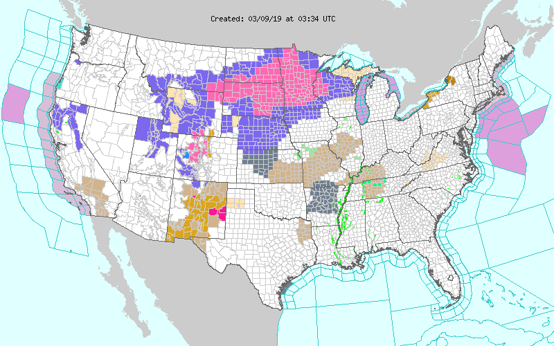
Along with another round of severe weather, moisture will also mix with the arctic air leading to more snow for the Upper Midwest. Winter Storm Warnings spread across parts of seven states.
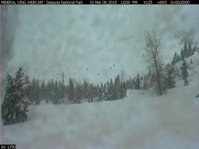
On the lighter side, the snow just keeps piling up across the mountains of the west.
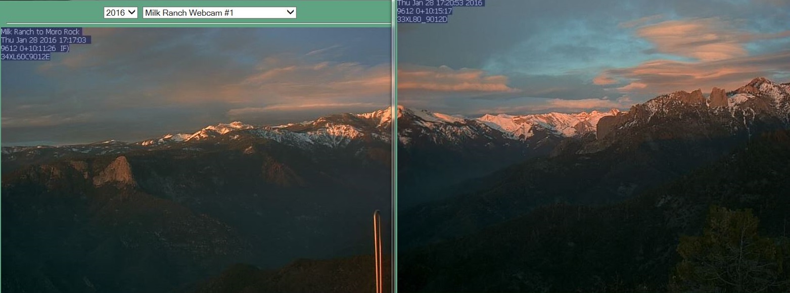
The Mineral King webcam is located at an elevation of 7830 feet in Southern Sequoia National Park. The Park is reporting a snow depth of 108 inches, or 9 feet.
Friday March 08, 2019 at1209pm
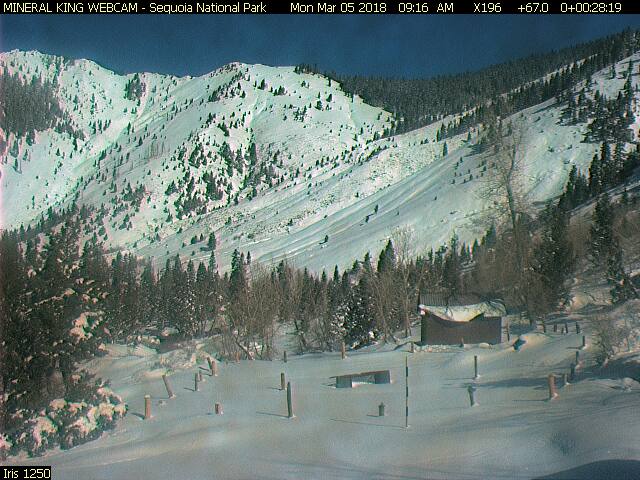
Below, the same location pictured last year in early March of 2018, note not only is the cabin mostly visible, you can also see the outline of the corral used in the summer months.
Monday March 05, 2018
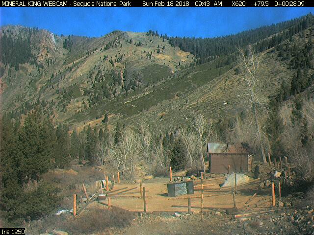
A few weeks earlier last year when the slopes of the Sierra were void of snow in the middle of February. All this to illustrate what a stormy 5 or 6 week stretch we have seen in the west since late January.
February 18, 2018
Mineral King and Farewell Gap webcams can be found at:
http://www.mk-webcam.net/
If you like the blog you will love the book.