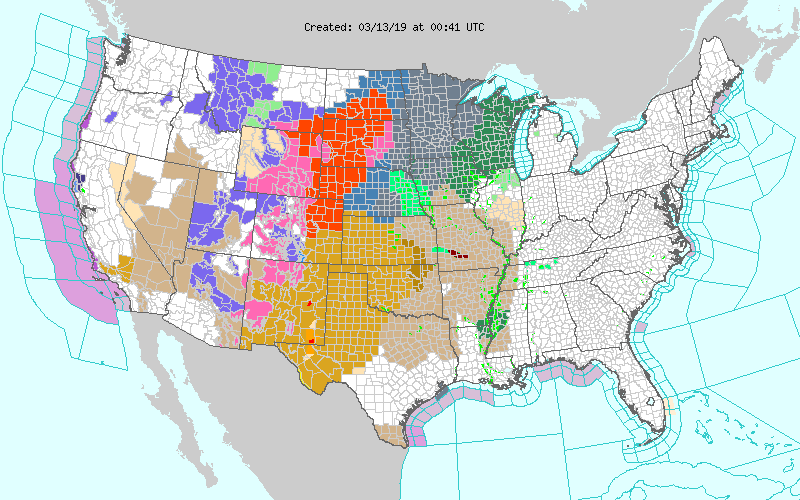
Daily Archives: March 13, 2019

Wind gusts to hurricane force from West Texas to Colorado

March 13, 2019  The potent wind storm has produced wind gusts to hurricane force over a wide area of real estate. The following is just a sample of what today’s storm has unleashed from the plains of west Texas to the Colorado Front Range.

In west Texas, Amarillo KAMA gust to 79mph,  2:53pm and 3:53pm, … Pampa KPPA gust to 72mph 2:35pm and 3:15pm
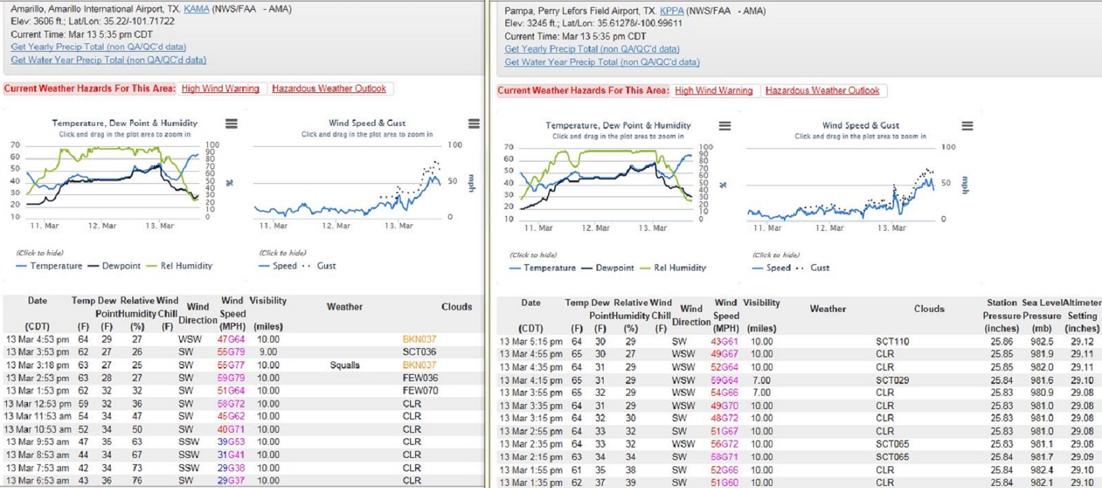
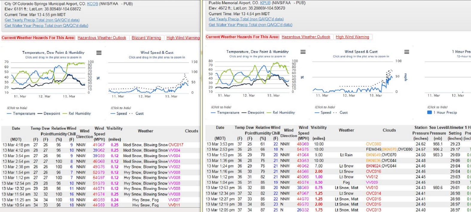
Along the Front Range, …Colorado Springs KCOS, gust 79mph 1:54pm, … Pueblo KPUB gust 74mph at 1:04pm
More Colorado observations, Limon KLIC gust 76mph at 1:41pm,  and even Denver KDEN  gust to 75mph at 10:53am
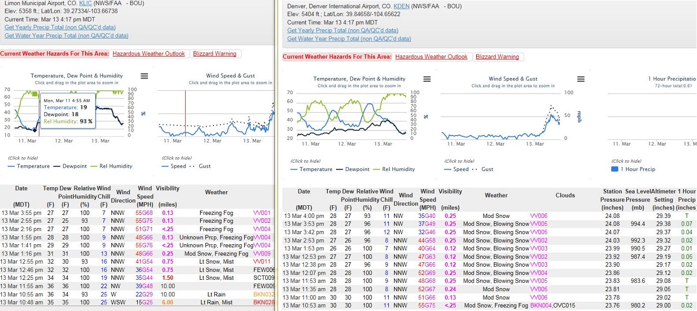
Note, … Texas skies were at worst were Partly Cloudy when the strongest winds occurred, But across Colorado falling and blowing  snow combined with the strongest winds to create sever blizzard conditions.  Folks will be talking about this storm for quite sometime.

Above observations retrieved from following NWS website:  https://www.wrh.noaa.gov/map/?wfo=lox&obs_type=weather&obs=true

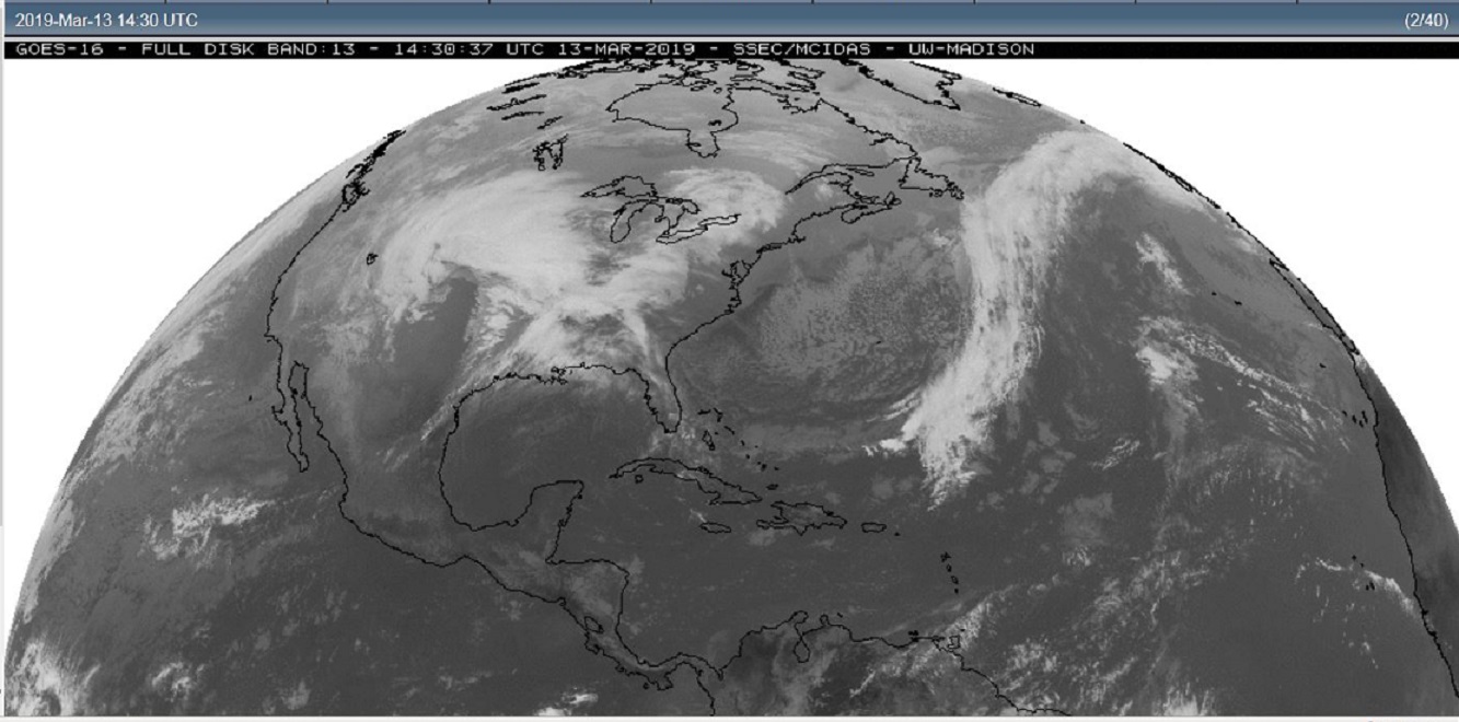
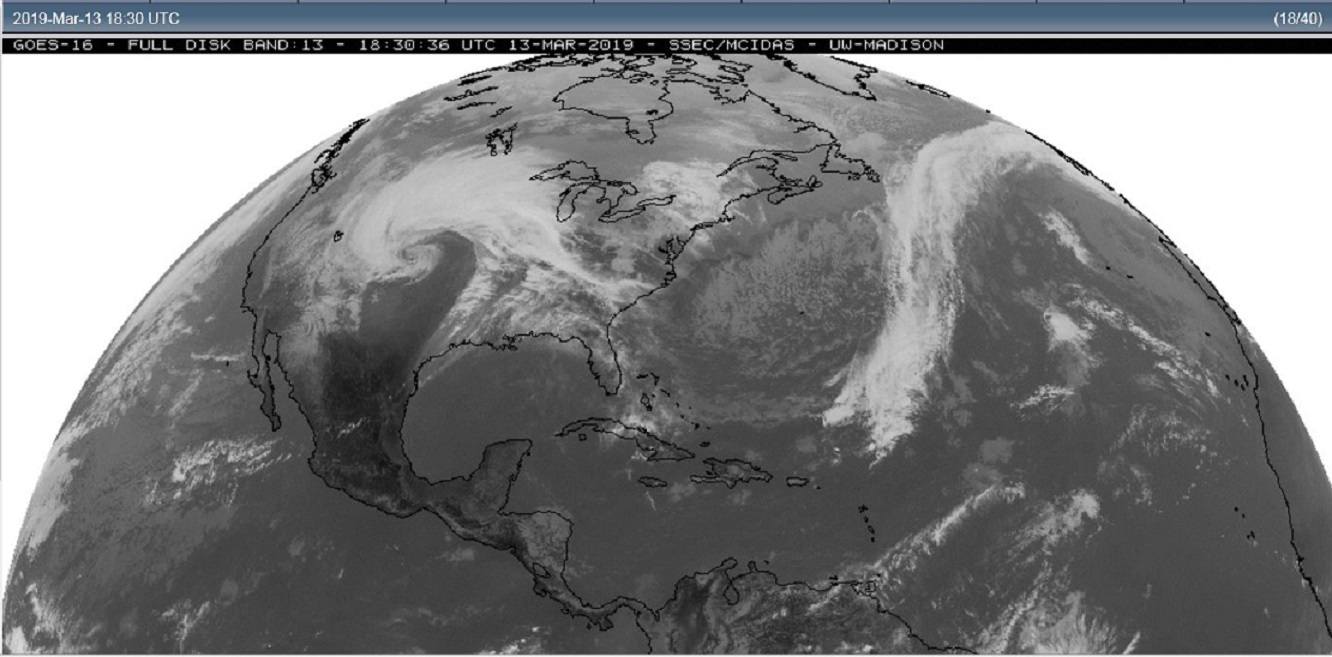
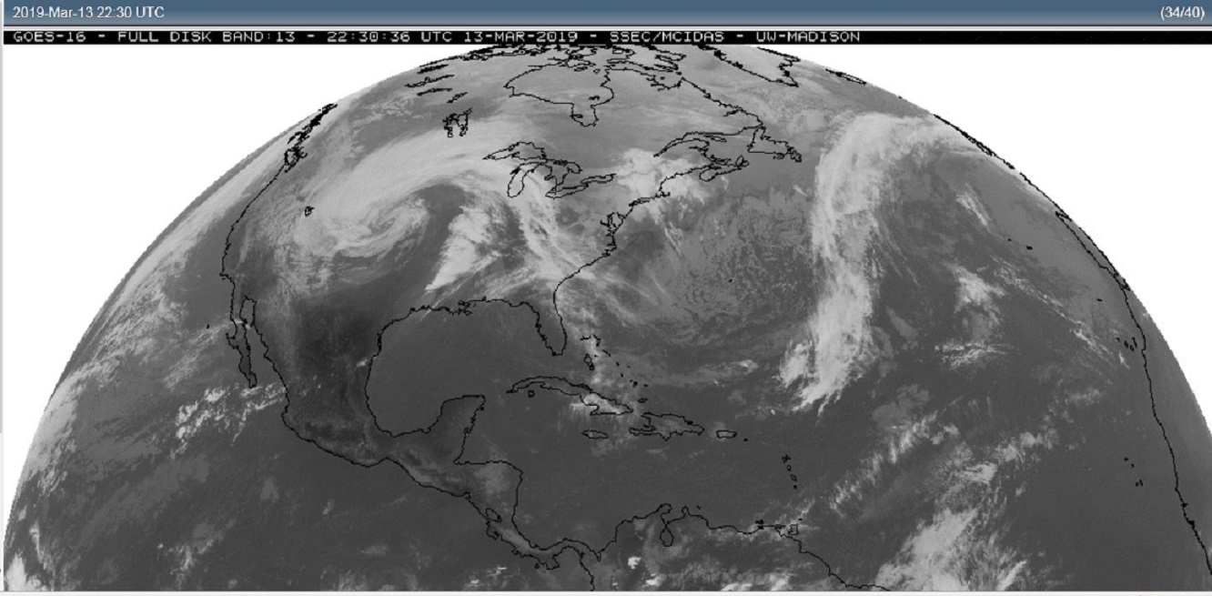
Below,  satellite pictures show the evolution of the storm during the day Wednesday.

March 13, 2019 morning or 1430z
March 13, 2019 early afternoon or 1830z
March 13, 2019 late afternoon or 2230z
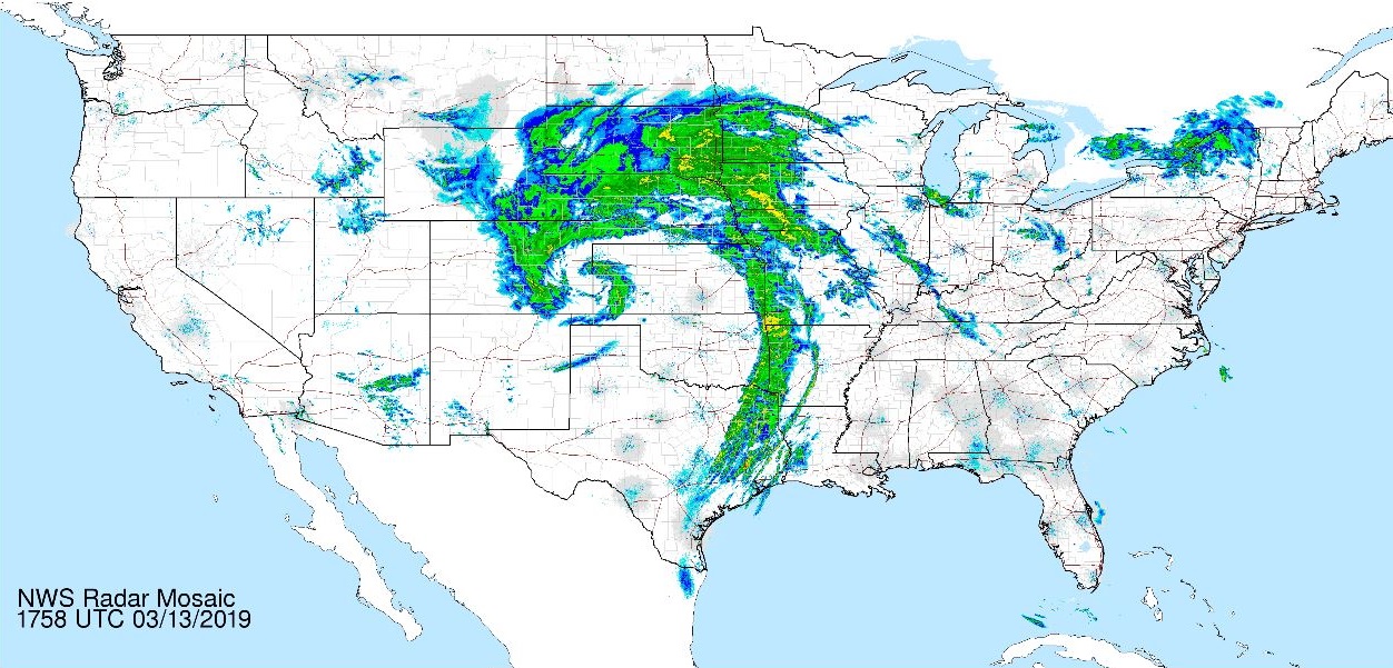
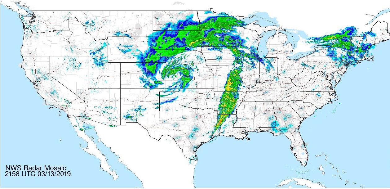
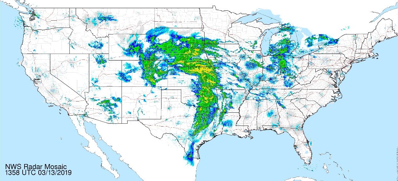
A snap shot of Wednesday’s national radar summary also showing the evolution of the storm during the day.  Tried to show similar times, 14, 18, and 22z.
So add another storm to the weather history of mid March, … The so called Storm of the Century buried much of the eastern seaboard March 13, 1993.  Two F5 tornadoes occurred in Kansas on March 13, 1990.

That’s all for now, …

Wild Bill
Deep low pressure brings a potent spring wind storm.

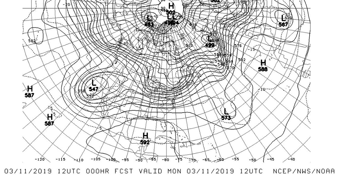
March 13,  2019       Deep low pressure brings a potent spring wind storm to the west and central portions of the country.  Two big bundles of jet stream energy are converging over the Western half of the North America today.  This will create an explosive storm that will spread its windy influence from the Rio Grande  to the Canadian border.

First,… the jet stream early Monday the 11,  which shows the upper low off San Diego, and the short wave racing across North Pacific toward the Pacific Northwest.

March 11, 2019 12z or early Monday morning,

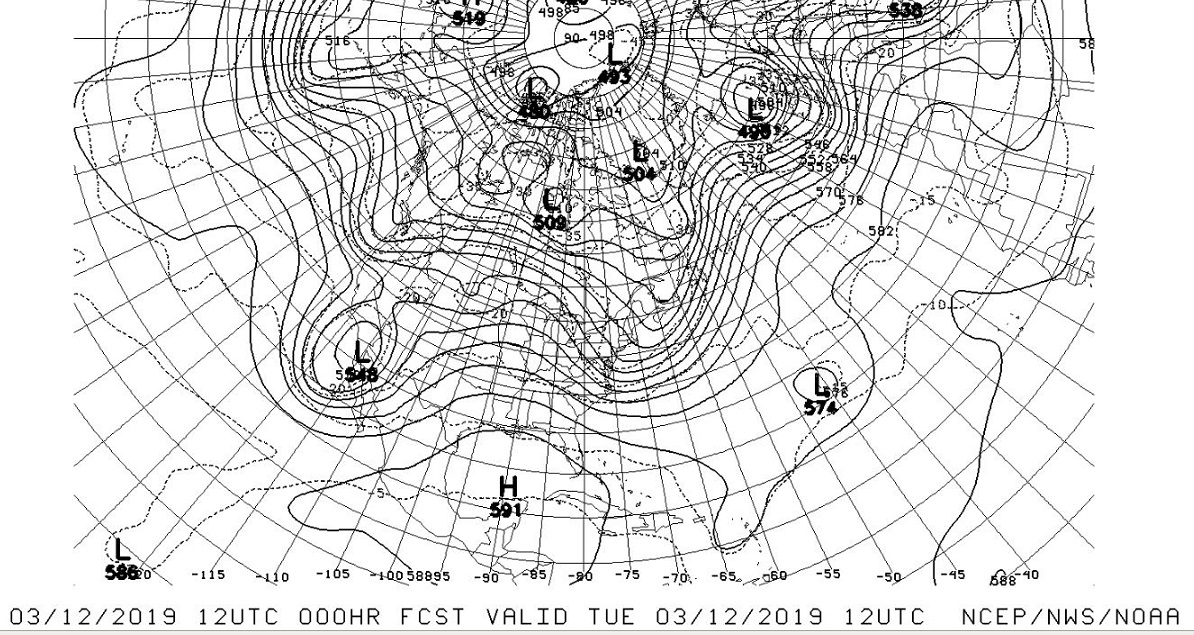
Second,… same chart 24 hours later, Tuesday morning,  the upper low pushes into Northern Mexico,  while the “kicker” shortwave is already diving into Cascades.

March 12, 2019 12z or early Tuesday morning,

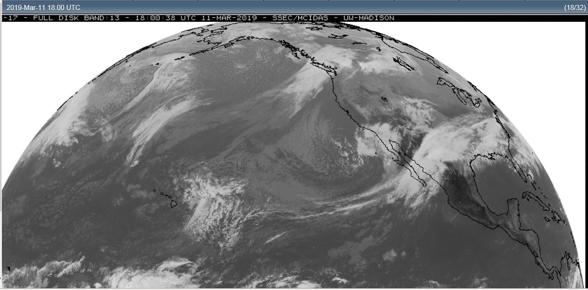
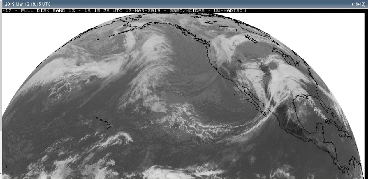
Third,… satellite pictures from Monday and Tuesday show both systems in the Eastern Pacific drawing ever closer to one another as they push into  Western North America.

March 11, 2019 18z or near midday Monday

March 12, 2019 18z or near midday Tuesday,

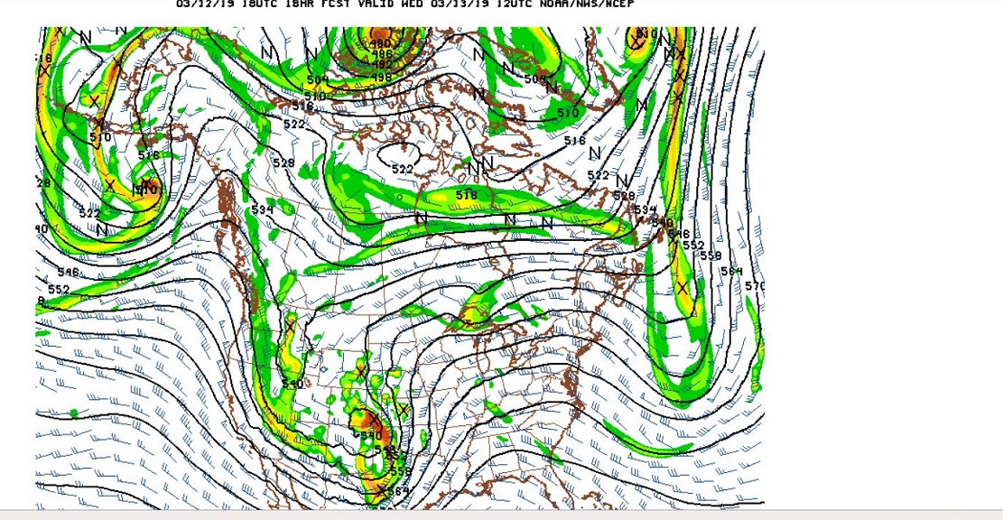
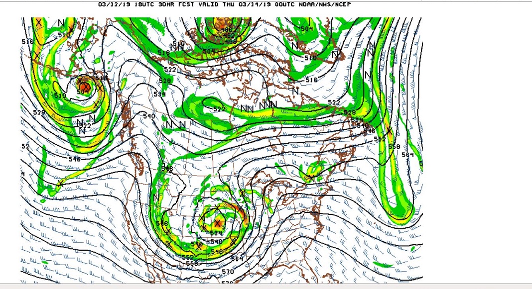
Fourth,…  forecast models for Wednesday the 13th showing the two disturbances merging over the west central US.  Go to your favorite weather modeling site and put the maps  in motion. The next 24 hours will be most impressive. Two distinct and separate disturbances suddenly become one massive storm.

12z or early morning Wednesday,

00z of the 14th, which is actually early evening Wednesday

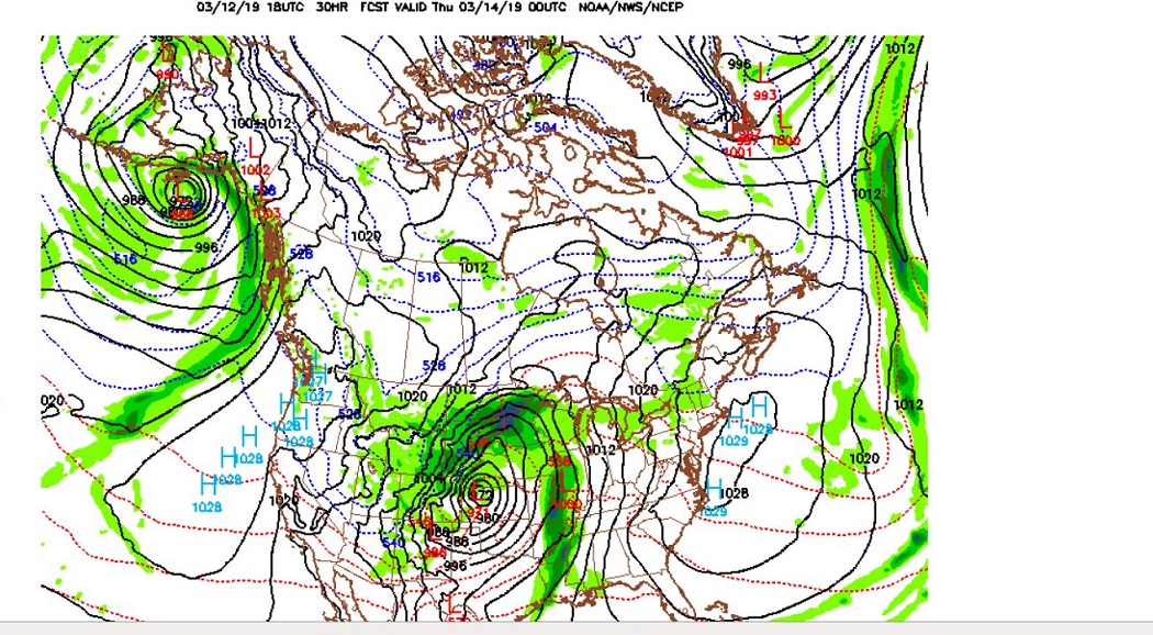
Five, …under the impressive new upper level disturbance is a deep surface low pressure system.  In the fine print, the central pressure of the storm by late Wednesday is forecast by the GFS to be about  972 millibars .  That pressure compares to a Category two hurricane.  Now pressure differences are spread over a much wider area with our jet stream driven storm.  So one would not expect sustained hurricane force winds.  But wind gusts to near hurricane force may be possible not only in or near thunderstorms, but also on the north and west side of the storm system where the pressure gradient becomes the tightest at the height of the storm.

So, lots of Warnings and Advisories for both Winter and Spring severe weather.

So,  please be weather aware on Wednesday, especially if your business takes you to any part of the country that will be under some form of weather warning during this massive storm.

Wild Bill…